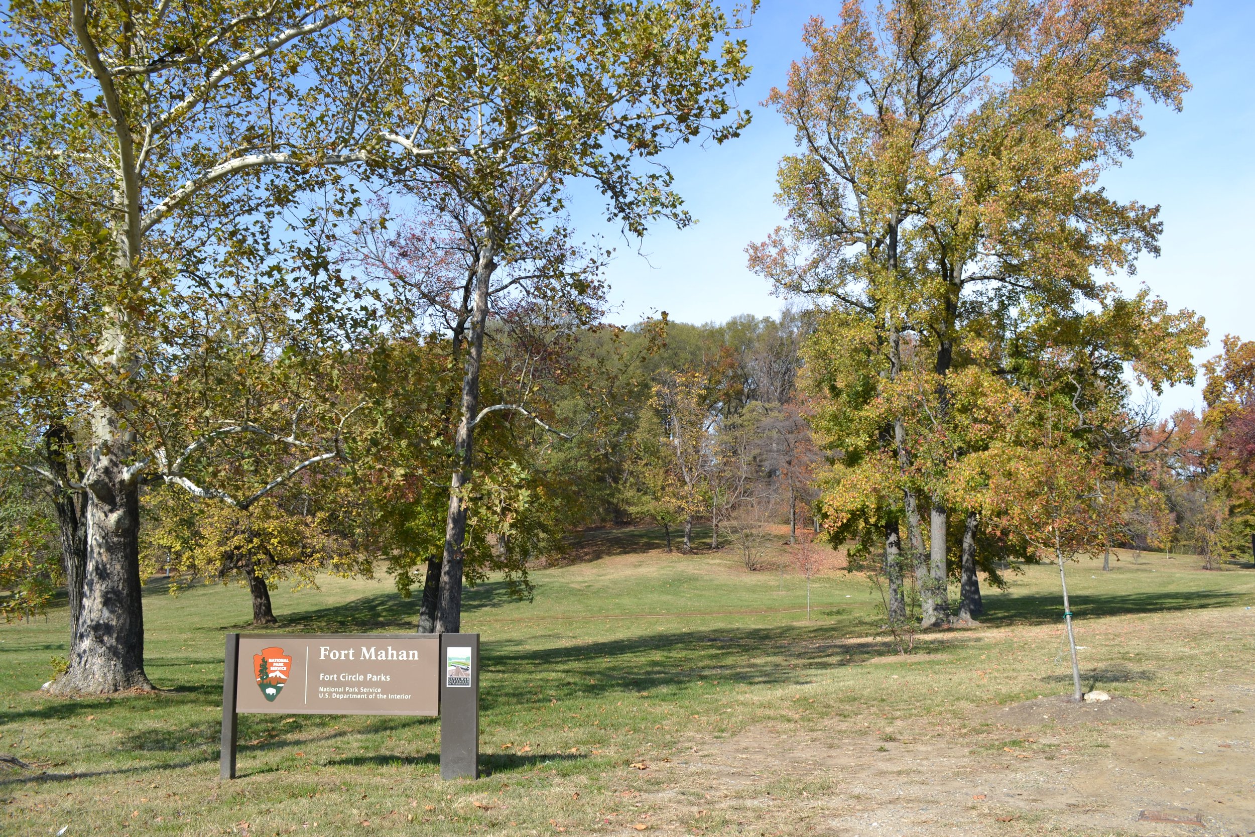
Fort Mahan Park
Washington, DC | 2012 - 2013
Cultural Landscape Inventory
Project Team: Randall Mason, Molly Lester
History
Fort Mahan was one of the 68 forts built as a defensive ring around Washington at the start of the Civil War. It was sited and designed to protect the Benning Road Bridge over the Anacostia River, as well as the Navy Yard and the Federal Arsenal nearby. It was named for Dennis Hart Mahan, a professor at West Point Military Academy whose writings were foundational texts for the Union Army’s tactics and strategy. By December of 1861, the fort was authorized to host garrisoned soldiers, although the majority of them stayed in the tent city near the outerworks. Fort Mahan did not have permanent barracks until 1862, when a storm damaged the tents and necessitated the construction of sturdier housing for the fort’s soldiers and laborers. By 1865, the buildings at Fort Mahan included a guardhouse, an officers’ quarters, and several other frame and log structures within the earthworks.
Fort Mahan was modified several times over the war, as engineers addressed vulnerabilities in the views available from the hilltop earthworks. General Jubal Early’s attack on Fort Stevens in July of 1864 instilled new urgency in the efforts to address Fort Mahan’s design flaws, although the fort never saw direct action. Three bastionets were added to the irregularly-shaped fortification, and by the end of the war, the perimeter of the nine-sided fort was 354 yards long. In addition, a ring of abates and 400 years of rifle pits serve as a buffer and a link to the other forts in the eastern sector of defenses. The threat of other Confederate attacks also prompted the removal of the remaining pre-war buildings on the crest of the hill, since they could potentially conceal snipers.
Despite—or perhaps because of—these alterations, Fort Mahan and the other defenses east of the Anacostia River were never subject to a Confederate attack. Their usefulness as a deterrent was clear, however, as General Early attested after the war. In the latter decades of the nineteenth century, the site reverted to Mary Manning and her family, who had owned the farm before the war. The fort itself continued to deteriorate as the Mannings rebuilt their structures on the site and repurposed the land for agricultural use again. Beginning in the last several years of the nineteenth century, small-scale mining and extraction processes evidently took place on the site, and continued into the early twentieth century under other (private) owners.
In 1902, the publication of the McMillan Plan spurred efforts to preserve Fort Mahan as part of a circle of green spaces around the city. This ring of parks would be established on the former sites of the Civil War Defenses of Washington, as part of the City Beautiful movement’s re-envisioning of the District of Columbia. Fort Mahan was, by this time, surrounded by emerging suburban development, and the site itself featured several buildings (including the Smothers School for Negroes) around its periphery, which was defined by several new streets.
The District’s efforts to acquire the land stalled until the late 1920s, when the National Capital Parks and Planning Commission (NCPPC) began to purchase land on the Fort Mahan site. On June 22, 1928, the NCPPC acquired the largest portion of land for the park, and most of the rest of the land was purchased by 1933. (The park did not reach its current boundaries until the early 1940s.)
The creation of the park at Fort Mahan corresponded with the formation of the Civilian Conservation Corps (CCC) during the Great Depression, and in 1935, a CCC camp was established to serve Fort Mahan and other nearby park sites. The CCC projects at Fort Mahan, conducted between 1935 and 1941, included forest protection, the infill of borrow pits, channeling of a spring, grading of the hill, and the construction of a picnic area (likely on the cleared hilltop) and a quarter-mile gravel road on the east side of the site. Annual reports for the District of Columbia also indicate that there were two playing fields on the site by 1940—probably on the hilltop and perhaps on the grassy area closer to the roads.
Analysis + Evaluation
Today, Fort Mahan is situated in the midst of a largely residential area of Anacostia. Its Civil War earthworks are largely demolished or deteriorated, although some fragments remain visible. The landscape retains most of the vegetation pattern and the features from its twentieth-century conversation to a park, with a cleared hilltop, overgrown hillsides, and a grassy periphery near the streets.
Fort Mahan exhibits the following landscape characteristics: topography, spatial organization, land use, buildings and structures, circulation, vegetation, views and vistas, and small-scale features.
Topography: The site for Fort Mahan was selected for its topography. Its position at 160 feet above sea level provided an elevated vantage of the surrounding landscape, including several strategic sites that Fort Mahan was designed to protect. The topography remains the same as it was throughout the historic period, and has a high degree of integrity.
Spatial Organization: The spatial organization of Fort Mahan dates to the later part of the historic period, when the site was converted to a park and the CCC implemented various forest protection and beautification projects on the site. There have been minor additions to the landscape in the form of wayfinding and interpretive signs since the later period of significance, but the site retains its historic spatial organization and has a high degree of integrity.
Land Use: The land use at Fort Mahan has not changed since the later part of the period of significance. The site remains a park, and is used for education and interpretation. As it has since the CCC era of involvement at the site, the park serves a public function and is open for general recreational use. Land use at Fort Mahan retains partial integrity.
Buildings and Structures: There are no auxiliary buildings from the periods of significance on the site today, but portions of Fort Mahan’s earthworks remain intact. The site retains partial integrity of buildings and structures due to these surviving features from the Civil War-era period of significance, including the extant bastionets and outerworks.
Circulation: Fort Mahan’s Civil War circulation pattern, including its military access road from Anacostia Road (now Minnesota Avenue) does not exist on the site today. The current paths, however, are consistent with the location of footpaths and trails that were in place during—and as a result of—the CCC’s work on the site. The gravel road on the northeastern corner of the site, which begins at 42nd Street NE and extends up the east side of the hill to the cleared area on the hilltop—was constructed by CCC laborers during the later period of significance, and the site retains integrity of circulation.
Vegetation: There was limited vegetation at Fort Mahan during the Civil War, in keeping with the site’s strategic design and use. The current vegetation pattern is not, therefore, consistent with the nineteenth-century period of significance, but the mature trees and cleared, grassy areas (around the edge of the site and on the hilltop) do correspond to the CCC-era period of significance, and their projects on the site. Fort Mahan’s vegetation retains a high degree of integrity from the twentieth-century period of significance.
Views and Vistas: The views and vistas from Fort Mahan during the Civil War extended to the countryside surrounding the fort—in particular, towards the west and the south. These vistas remained intact for several years after the war, but the redevelopment of the site and surrounding area in the twentieth century affected the views from the landscape at Fort Mahan. Moreover, the most significant aspect of the fort’s original vistas—that is, its view towards Benning Road Bridge—is obstructed today by later growth on the site. Present day views retain no integrity from the period of significance.
Small-Scale Features: A limited number of Fort Mahan’s small-scale features date to the later period of significance. None of the site’s Civil War-era small scale features survive. Those that are likely from the twentieth-century period of significance include the football uprights, the pole (which is either a flagpole or the remnant of a second football upright), and the light posts on the crest of the hill. Many other small-scale features from the CCC era of significance, including the baseball diamond and the picnic tables and benches, are no longer extant. Most of the non-contributing small-scale features (including wayfinding, regulatory, and interpretive signage) have been installed since the historic period. The small-scale features retain some integrity.

1861: Boschke map of the District of Columbia, with future hilltop site of Fort Mahan highlighted. (Library of Congress, Geography and Map Division)

Comparison of the 1861 Boschke map (left) with the 1861 Lines of Defense map (right), developed by Major General John G. Barnard. Barnard’s map of the fortifications around Washington used Boschke’s survey as a base map, superimposing the location of the hastily-built forts on the existing map. (Boschke map, Library of Congress, Geography and Map Division; Lines of Defense map, Historic Map Works Rare Historic Maps Collection)

Engineer drawings of Fort Mahan: original (top) and reshaped (bottom), with three bastionets inserted in the perimeter. (National Archives, as printed in Mr. Lincoln’s Forts)

1879 G. M. Hopkins map (top) and 1884 Lydecker and Greene map of the Manning property, showing structures concentrated on the hilltop and along Benning Road. Some or all of the structures on the hilltop likely date to the Civil War construction on the site, and the access road (from Anacostia Road, on the western boundary of the site) is consistent with the military access road from the war. (Library of Congress, Geography and Map Division; NOAA Historical Map and Chart Collection)

1888 topographical map, indicating traces of the fort’s outerworks (including the bastionets) on the hilltop. The crest of the hill featured limited vegetation at this point (consistent with the Civil War clearcutting of the site), with the exception of the domestic-scale agriculture between the outerworks and the house on the west side of the hilltop. Although the outerworks remained somewhat intact on the site at this point, there is no evidence of any other remaining Civil War-era structures. (NOAA Historical Map and Chart Collection)

By 1903, the site was fully bound on its southern, western, and northern edges by roads and development, while the center of hill remained largely clear. (Library of Congress, Geography and Map Division)

The 1903 Baist map (top) is the last known indication of a house on the crest of the site. By the time the 1913 Baist map (bottom) was surveyed, the house was removed. Development on the periphery of the site continued to be concentrated along Benning Road, at the southeast corner of the hill. (Library of Congress, Geography and Map Division)

Images from the Civilian Conservation Corps’ 1935 narrative report, depicting (top-bottom): CCC workers “removing undesirable undergrowth and burning brush”; “a typical scene taken at Fort Mahan showing area after undesirable materials were removed”; and “view of pitted areas that exist at Fort Mahan.” The vantage of the bottom photograph is not specified, but it was likely taken from high on the hill’s western side, looking west toward the borrow pits and gullies on that portion of the former fort site. (National Archives and Records Administration, College Park, Maryland)

1927 aerial photographs of the site note the presence of footpaths around the site. The gravel road on the eastern half of the site was not yet in place, reinforcing the conjecture that it was installed six years later by the Civilian Conservation Corps. (National Archives, College Park, Maryland, Cartographic and Architectural Records Section, Special Media Archives Services Division)

Today, visitors can reach the hilltop at Fort Mahan via the gravel road on the eastern side of the site. Beginning at 42nd Street NE, the road intersects with one of the social trails on the site (top) and features a metal gate halfway up the slope (bottom). (M. Lester 2012)
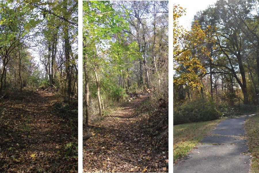
Extant social trails on Fort Mahan are both dirt trails (left, center) and paved (right). They include a circumferential hiker-biker trail around the hill, as well as several spurs that go up the hillsides from the wooded and grassy areas at the bottom of the site to the cleared area at the top. (M. Lester 2012)
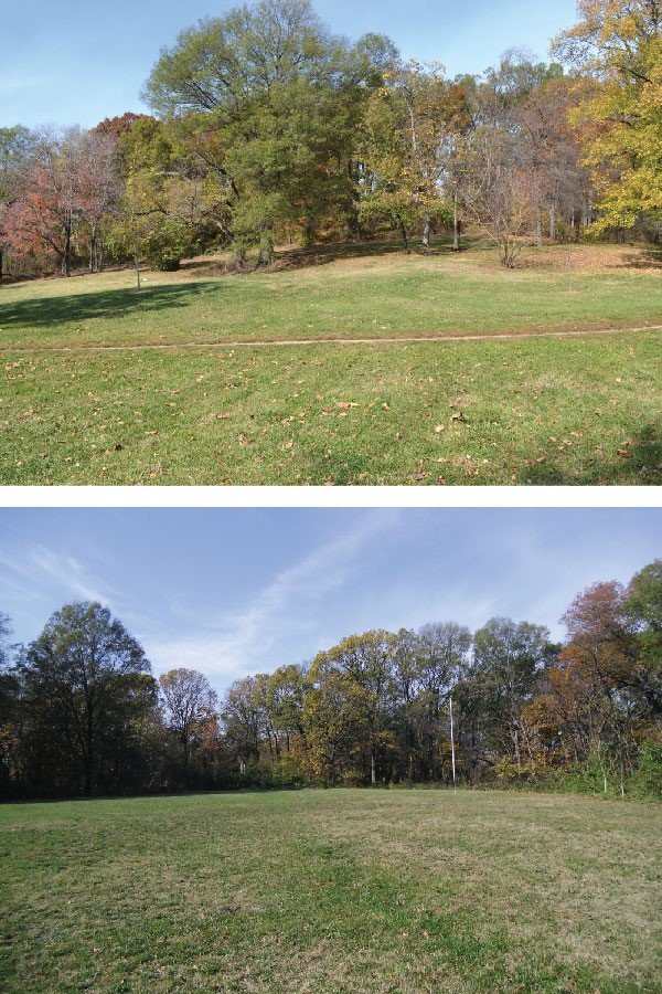
Fort Mahan’s current landscape is grassy around the periphery, particularly on the eastern and southern sides of the site (top), and at the crest of the hill (bottom). This cleared area on the hilltop is the likely location for the picnic area that the Civilian Conservation Corps installed on the site in the 1930s. (M. Lester 2012)

The hillsides surrounding the crest are covered with a thick growth of mature trees and low brush. (M. Lester 2012)

The site features a few specimen plantings in cleared areas near points of access, including a Virginia pine near the CCC-era gravel road (left) and London plane, willow oak and catalpa trees near footpaths at the southeast corner of the site (right). (M. Lester 2012)

Fragments of the earthworks remain partially intact today, including the some of the original bastionets. Views from inside the bastionets, looking out. (M. Lester 2013)

The site’s original views toward the Benning Road bridge are obstructed today by growth and development on and around the hill. (M. Lester 2012)

Several of the extant small-scale features on the site correspond to the use of the hilltop as a football field. (This may date to or postdate the CCC years on the site.) These features include a set of football uprights (top) and a light pole (bottom) at the north end of the cleared crest.