Fort Myer
Arlington, Virginia | 2020 - 2021
National Historic Landmark Nomination Update
Project Team: Randall Mason, Molly Lester, Joshua Lewis, Margaret Sollmann
Summary Statement of Significance
(NHL Section 5)
The Fort Myer Historic District in Arlington, Virginia is nationally significant as a key installation of the United States Army, established as Fort Cass/Fort Whipple during the Civil War and maintained as a base for over 150 years. The district, which abuts Arlington National Cemetery and overlooks Washington, D.C., made substantial and significant contributions to the nation with respect to military defense, architecture/site planning, communications, aeronautics and aviation, and Black heritage. It is nationally significant based on its association with General Albert J. Myer, who spearheaded the U.S. Signal Corps School on the site and for whom the base was subsequently renamed.
In contrast with other military installations that were formally laid out (or redesigned) during one period, the Fort Myer Historic District demonstrates an adaptive approach to design and operations, with a campus and collection of resources that evolved over decades of military use. The historic district’s contributing resources represent several distinct periods of construction and use, as the U.S. Army has cultivated a landscape of residential, equestrian, and military resources that evolve with military tactics and technologies.
Listed on the National Register of Historic Places and designated as a National Historic Landmark (NHL) in 1972, the historic district features a collection of late-19th and early-mid 20th century buildings organized around key contributing sites, including the parade ground at Summerall Field. Together, these resources represent several development campaigns, spanning officer residential areas and barracks from the late-19th century and interwar periods, cavalry facilities, and other supporting function buildings that are still in operation, either in their continued historic use or a contemporary and compatible reuse.
The Historic District is part of the Joint Base Myer-Henderson Hall, which includes the U.S. Army Post Fort Myer, the neighboring U.S. Marine Corps Military Installation Henderson Hall, and nearby U.S. Army Post Fort McNair. (The historic district is located solely within the boundaries of Fort Myer, and does not include any resources from Henderson Hall or Fort McNair.) The period of significance extends from 1861 to 1949, beginning with the establishment of Fort Cass in 1861 and continuing until 1949, when the 10th Cavalry departed Fort Myer and the historic district was no longer associated with a cavalry post.
The Fort Myer Historic District is nationally significant based on the following National Historic Landmark criteria: Criterion 1, for the district’s association with nationally-significant contributions to U.S. Military history, demonstrated by its association with the U.S. Signal Corps, Aeronautical Division, and U.S. Cavalry; Criterion 2, for its association with General Albert J. Myer; and Criteria 4 and 5, for its development as a cavalry post and officers’ residential community following its tenure as Fort Whipple, as well as its ongoing expansion through the early 20th century as part of the interwar period.
Summary Description + Integrity
(NHL Section 6)
The Fort Myer Historic District occupies the northern section of the current boundaries Fort Myer in Arlington, Virginia; it does not include the areas historically known as the Lower Post Area or the South Post, and it does not include the Old Post Chapel. The district includes a combination of residential, social, equestrian, and service buildings and structures, and is organized around two large open spaces: Whipple Field (at the northeast corner of the historic district) and Summerall Field (at the southern end of the historic district). The district’s resources are organized along four streets within the installation—Grant Avenue, Jackson Avenue, Lee Avenue, and Sheridan Avenue—with additional resources along secondary streets. In contrast with other military installations that were designed and constructed during a singular period, the Fort Myer Historic District represents several distinct periods of construction; many of its buildings embody the shifting design movements standardized by the Quartermaster’s Plans.
As preparation for this updated nomination, the nominators led a field survey of the historic district in June and July of 2021, identifying any resources that have been demolished, altered, or deteriorated since the historic district was designated, and evaluating the significance and integrity of all extant resources.
Integrity of the Historic District
Within the historic district boundaries, the majority of resources retain and convey their historic associations and designs (including those that follow the Quartermaster Plans), and in some cases, their historic uses. All buildings are in either partial or full occupied use, and their exterior envelopes are in generally good condition. Several buildings are experiencing brick spalling or deteriorating wood features, but these conditions issues do not detract from the overall historic integrity of the district.
A portion of the resources have experienced exterior alterations or additions made to the original fabric, including—but not limited to—wing extensions, window/door infill, building connectors, and porch reconstructions. These elements do not detract from the historical or architectural integrity of the original design, materials, and associations of the buildings. Rather, many of these alterations are consistent with the continuous use of Fort Myer as a military installation, as they reflect the evolving needs, capacity, designs, and treatments of the historic district as one of the United States Army’s most significant installations in the country.
The Fort Myer Historic District’s period of significance for this updated nomination is 1861-1949, a period that reflects the cultural landscape’s historic use as a military operation, the fort’s operation as the base for the Signal Corps and School (1869-1886), and the historic association with the U.S. Cavalry (1887-1949), including the Buffalo Soldiers of the 10th Cavalry. As a district, the Fort Myer Historic District retains a high degree of integrity with respect to location, design, setting, materials, workmanship, feeling, and association. The district retains its integrity of location as most of its significant resources as a cavalry base remain intact in their historic locations, as well as the original street layouts drawn by Albert J. Myer while the fort served as the Signal Corps and School. The district retains integrity of design based on its intact cavalry building stock, as well as the extant buildings erected according to the Army’s Quartermaster Standardized Plans. The district’s setting is key to its historical significance for its relationship to the fort’s evolution as a high vantage point overlooking Washington D.C. as part of the Union’s Arlington Line during the Civil War to training grounds for the Signal Corps and later U.S. Cavalry. The district retains integrity of materials and workmanship as evidenced in particular by Building 42, which was designed to be easily assembled and disassembled as the fort expanded. The district retains integrity of feeling and association because it remains legible as a military installation on the elevated ground southwest of Washington, D.C., consistent with its establishment as a fort and the historic conditions cultivated by the U.S. Army during the period of significance.

Orville Wright and Lieutenant Lahm of the United States Signal Corps making the world's record flight at Fort Myer, on July 27, 1909. (Harris & Ewing, Orville Wright and Lieutenant Lahm of the United States Signal Corps making the world's record flight at Fort Myer, on July 27--The aeroplane made fifty miles at a speed of about forty miles an hour [Fort Myer, Virginia, 1909] Photograph, Library of Congress, https://www.loc.gov/item/97505201/)
![Wright flights at Fort Myer in July 1907. (Harris & Ewing, Wright Flights, Fort Myer, Va; July First Army Flights; Wilbur And Orville Wright, Charlie Taylor; Putting Plane On Launching Rail [Fort Myer, VA: (July) 1909], Photograph, Library of Congres](https://images.squarespace-cdn.com/content/v1/6140e3c6390abd159b410cb8/6e8b185f-a3fb-489e-b81c-f60a0d374279/1909-07_Wright+flights%2C+Fort+Myer_LOC.jpg)
Wright flights at Fort Myer in July 1907. (Harris & Ewing, Wright Flights, Fort Myer, Va; July First Army Flights; Wilbur And Orville Wright, Charlie Taylor; Putting Plane On Launching Rail [Fort Myer, VA: (July) 1909], Photograph, Library of Congress, https://www.loc.gov/item/2016863807/.)
![Cavalry skills demonstration at Fort Myer, sometime between 1909 and 1940. (U.S. Army, Ft. Myer, Va. Fort Myer, Virginia: [between 1909 and 1940] Photograph, Library of Congress, https://www.loc.gov/item/2016823085/.)](https://images.squarespace-cdn.com/content/v1/6140e3c6390abd159b410cb8/7158bd18-c6e0-4136-b95f-84bad489341e/1909+1940+between_US+Army+%282%29%2C+Ft+Myer_LOC.jpg)
Cavalry skills demonstration at Fort Myer, sometime between 1909 and 1940. (U.S. Army, Ft. Myer, Va. Fort Myer, Virginia: [between 1909 and 1940] Photograph, Library of Congress, https://www.loc.gov/item/2016823085/.)
![Troops in front of the Sheridan Avenue barracks, sometime between 1909 and 1940. (U.S. Army, Ft. Myer, Va. Fort Myer, Virginia: [between 1909 and 1940] Photograph, Library of Congress, https://www.loc.gov/item/2016823082/.)](https://images.squarespace-cdn.com/content/v1/6140e3c6390abd159b410cb8/bbe4db0d-b118-418f-bdc2-def74bb90435/1909+1940+between_US+Army%2C+Ft+Myer_LOC.jpg)
Troops in front of the Sheridan Avenue barracks, sometime between 1909 and 1940. (U.S. Army, Ft. Myer, Va. Fort Myer, Virginia: [between 1909 and 1940] Photograph, Library of Congress, https://www.loc.gov/item/2016823082/.)
![Cavalry horse show at Fort Myer, sometime between 1915 and 1923. (Harris & Ewing, Cavalry horse show at Fort Myer, [Fort Myer, VA: (between 1915 and 1923)] Photograph, Library of Congress, https://www.loc.gov/item/2016885194/.)](https://images.squarespace-cdn.com/content/v1/6140e3c6390abd159b410cb8/2ad95165-1a39-411c-a96a-455a210e3ccf/1915+1923+between_Cavalry+horse+show+at+Fort+Myer_LOC.jpg)
Cavalry horse show at Fort Myer, sometime between 1915 and 1923. (Harris & Ewing, Cavalry horse show at Fort Myer, [Fort Myer, VA: (between 1915 and 1923)] Photograph, Library of Congress, https://www.loc.gov/item/2016885194/.)
![Fort Myer Officers Training Camp, 1917. (Harris & Ewing, Fort Myer Officers Training Camp [Fort Myer, VA: 1917] Photograph, Library of Congress, https://www.loc.gov/item/2016867851/.)](https://images.squarespace-cdn.com/content/v1/6140e3c6390abd159b410cb8/36453e9f-f5f9-4b03-873d-42bc5c98303b/1917_Fort+Myer+Officers+Training+Camp+%282%29_LOC.jpg)
Fort Myer Officers Training Camp, 1917. (Harris & Ewing, Fort Myer Officers Training Camp [Fort Myer, VA: 1917] Photograph, Library of Congress, https://www.loc.gov/item/2016867851/.)

Quarters 1 (201 Washington Avenue). 2021. Photo courtesy of Joint Base-Henderson Hall (Fort Myer).
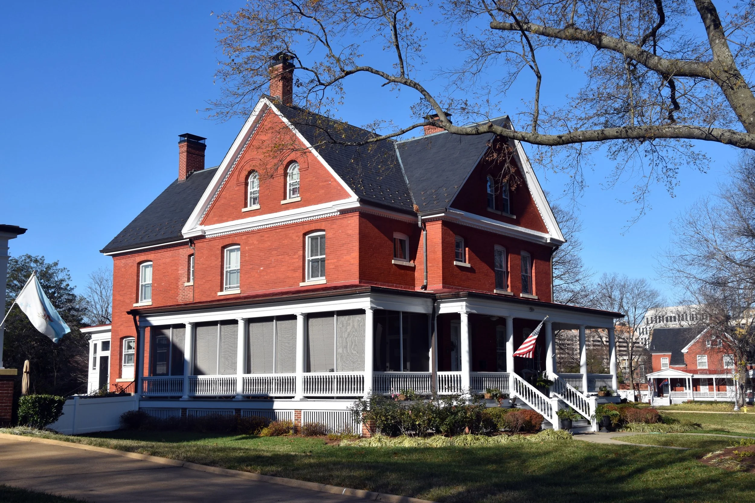
Quarters 5 (114 Grant Avenue). 2021. Photo courtesy of Joint Base-Henderson Hall (Fort Myer).

Building 217 (202 Jackson Avenue). 2021. Photo by the nomination authors.

Building 233 (110 Forrest Circle). 2021. Photo by the nomination authors.

Building 246 (402 Sheridan Avenue), one of the Sheridan Avenue barracks. 2021. Photo by the nomination authors.

Summerall Field memorial (foreground) and parade ground (background). 2021. Photo by the nomination authors.

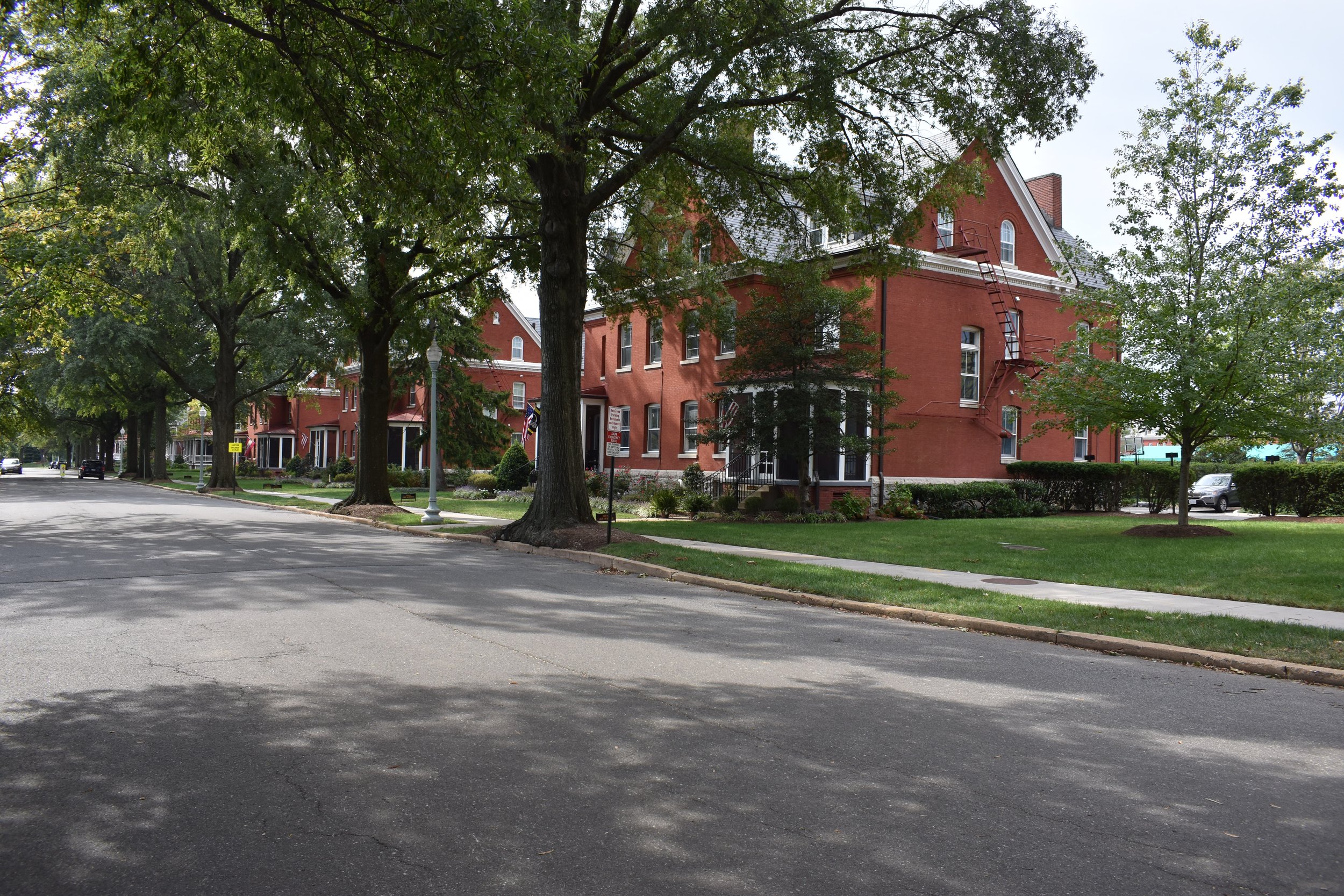
Jackson Avenue. 2021. Photo by the nomination authors.

Building 42 (114 Washington Avenue), oldest extant building within the historic district. 2021. Photo courtesy of Joint Base-Henderson Hall (Fort Myer).

Building 59 (204 Lee Avenue). 2021. Photo courtesy of Joint Base-Henderson Hall (Fort Myer).